Translate

Saturday, August 30, 2008

Portland, OR (actually Tualatin, OR)


Last night was a pleasant campground with a number of amenities that we didn't use. The downside was that it abutted I-182, and there was continual traffic. We had gotten spoiled by some very quiet, rustic campgrounds. We spent the bulk of the day on I-84 following the south shore of the Columbia River and the route of Lewis and Clark. Even though it is an interstate, the scenery is wonderful. The picture is looking upstream at the lower end of the gorge. It's a major river. The difficulty was that the winds were right in our teeth at 30 to 40 knots, and since they were being funneled up river through the Columbia River Gorge, they were turbulent. The river was full of wind-surfers who were gleefully flitting from white-cap to white-cap, while I was gripping the steering wheel with great attention. While I normally get over 8 mpg, today was 7.1. This is in spite of a reduced speed and a generally descending trip. Those headwinds are tough on a motorhome.
It is really fascinating to make the drive from eastern to western Oregon (or Washington). The transition from high plains prairie to verdant coastal forest is dramatic.
Tomorrow we'll pick up our forwarded mail at Andy Rux's house and pay a visit to Andy in the hospital. We'll have lunch with Dale.

Friday, August 29, 2008

Pasco, WA


This morning we took an intersting side trip to Athol, ID, population 696. There may be some of you in my vast readership that didn't know that Durelle and I grew up and were married in Athol (Massachusetts). So we thought a visit would be a good thing to do. Inside the City Hall (shown above, we met a most pleasant lady, Charlotte Hooper. She's the city clerk, food bank director, and I'd bet the de facto mayor, too. We talked for a couple of hours, and learned, among other things, that both towns derive their names from the Scottish Duke of Atholl.
We returned to Coeur d'Alene, packed up and left about 1130. We stopped at a rest area about an hour west of Spokane for lunch. The picture shows a terrain that is very similar to the plains of Montana or North Dakota. It is NOT what you think of when you think of Washington. But, eastern WA has most of its rain stolen by the mountain ranges in western WA and, as a result, is classic prairie. The temperature when we arrived was 90 in a strong sun, but tomorrow will be cooler. We have had no complaints on the weather.

Thursday, August 28, 2008

Coeur d'Alene, ID

Hello again. We only had about 165 miles today, and it was a good thing. There was a large RV and marine (??) dealership between the KOA in Missoula and our re-entry onto I-90. So we (?) decided to get the electric flush toilet repaired. We could have continued to use the admittedly awkward manual flush capability until we got to the Tiffin Rally next month and got it fixed for free. But I guess it was $120 well spent...it was an awkward, inaccessible job. We were told to come in at 1230 for what was expected to be an hour. That suited our schedule just fine, because the earliest check-in time here in Coeur d'Alene was 1400 and we gained an hour. We are now in Pacific time. Besides, I wanted to do a little shopping, and I wanted to stop into the Bennet Law Firm in Missoula. They are the folks that created the Montana LLC under which we have registered the bus. After two years of emails, it was nice to put some faces with the email addresses. As it turned out, the maintenance was 3 1/2 hours. We got away at 1600 Mountain and arrived at 1800 Pacific.
I was quite surprised to find that Coeur d'Alene is only at 2000 feet. We climbed to 4500' at Lookout Pass on the MT/ID border than descended to Coeur d'Alene. Thank goodness for the Jake brake. There were several "runaway truck" escape lanes. At least Durelle got to enjoy the scenery.
The campground is on an Blackwell Island in Coeur d'Alene Lake where it dumps into the Spokane River. There are dozens of high end rigs that make us look like Okies from "The Grapes of Wrath". No tents are allowed. But $36 was a good price. Tomorrow is another short day, and we are going to drive up to Athol, ID for a photo op.
No pictures tonight, but there should be some tomorrow. This is a majestic area.

Wednesday, August 27, 2008

Missoula, MT


We are on the move again. They don't call Montana the big sky country for nothing. Today was 285 miles of straightforward driving, but with again a head/cross wind. We topped 6300 ft east of Bozeman, but we are 3000 feet below that tonight in Missoula. I have already made arrangements with a local, large RV dealership to finish the installation of a new switch for the toilet flusher. The manual over-ride is inconvenient. Today was the first traffic jam yet. After we got set up, I went to Albertson's and was amazed at the traffic. Another difference today was that the campground had a nice, enclosed dog run. So Belle had a chance to romp with a bunch of youngsters. I am going to include a few more pictures from Yellowstone. The last picture in the group is a picture of our campground in Gardiner, MT as taken from INSIDE Yellowstone.

Tuesday, August 26, 2008

Yellowstone IV


Well, we just finished our third (and probably last) day of touring Yellowstone National Park. We put 490 miles on the Jeep in three days and still did not travel all of the major roads in the park, much less the minor gravel side trips. I'm convinced that you could spend a summer here without ever getting bored. On an interesting side note, those 490 miles took just a bit less than 22 gallons for a mileage of about 22.5. That is significant because the Jeep almost never breaks 20mpg. The driving, as you can imagine, involved significant amounts of climbing steep grades, low gear engine braking down grades (once using 4WD low range!), and frequent applications of brakes. Nonetheless, we got 22.5. Do you s'pose the fact that my average driving speed was around 30mph was a factor? Ya think? This trip has driven home the fact that, if you want to save a little fuel, slow down!

OK, I have decided what pictures to attach. After two days in the park we had seen only one elk. This morning there was a herd of them bedded down at Park headquarters. I guess that grass with Turf Builder Plus 2 is sweeter than that stuff mother nature provides. A short time later, well away from civilization, we found a very large bull rattling his antlers against the trees. It is a rear view picture, but it shows his size. What a variety of terrains exist in the various parts of the park! The focal point today was Canyon Village where can be found the upper and lower falls as the Yellowstone River descends through the "Grand Canyon of the Yellowstone". The upper falls drops over 100 feet, and the lower falls drop over 300 feet. The vantage point is called Artist's Point. It would be, too, except that the thousands of crowding tourists would keep knocking over your tripod and easel. Seriously, I sat on a log bench and stared upriver at the falls through a veil of evergreen branches and felt like I could stay there forever. This camera goes from 35 to 420 mm eq. Yet I kept thinking that my wide-angle lens was not wide enough.

It should be noted that I can only attach about 10% of the pictures to the blog. Today I took 45, and there were no rejects. It is difficult to decide which ones to include. I guess I can pick a few and send a few more from Missoula tomorrow. The camera may get a bit of a break for a couple of days.
By the way, today we committed to being a seasonal camper at the Moorings RV Resort in Belfast, ME for 2009 again.

Monday, August 25, 2008

Yellowstone III


To steal a line from Cindy, the geezers did the geysers. This part of Yellowstone is very different from the northern tier. Here, we are sitting on top of a volcano. The hot magma which forms the core of the planet is close to the surface. When the snow melt finds its way down through the fissures in the rock, it reaches a source of heat. Sometimes the resulting steam issues forth from a fissure as steam. Sometimes it bubbles up through mud and spreads out as the typical hot springs. On other occasions it is constrained by some sort of restriction, builds up pressure and eventually breaks loose and spews into the atmosphere. Old Faithful is unique in that the constriction releases every 97 +/- 2 minutes. It is not the most colorful, but it is dramatic.


Driving through an animal park is traversing perhaps a hundred acres with lots of fences. Yellowstone is a million acres with NO fences. We have spent 16 hours in the Jeep and haven't scratched the surface.


Internet access has been tentative. It is not the fault of the campground which has a good WiFi setup. And the dog walk service has been outstanding. We have been making reservations along our revised schedule. Andy, we now plan to hit the Roamer's Roost on Saturday and leave on Monday. There are two packages on the way. Sunday should be a relaxed visit.

Sunday, August 24, 2008

Yellowstone II


Today was one of those 240 mile, non-driving days. We left Gardiner, MT at 0800 to drive across the northern part of Yellowstone to the Northeastern Exit. That took a couple of hours. We saw a single elk, a couple of mule deer, a small herd of antelope and large herds of bison. Outside the Northeastern gate is Cooke City, MT. From there it is 60+ miles to Red Lodge, MT. The route is Rt 212, but it is better known as the Beartooth Highway. It starts and ends at about a mile high, but spends much of its time at two miles high. The 60 miles to and from Red Lodge each take about two hours plus photo stops. Whereas northern Yellowstone is majestic high forest and plains, the Beartooth Highway (outside the park) is high-altitude, long-range viewage. I think we topped out at 10,947 feet. The road is a paved, two wide, no shoulder road with many dozens of U-turn switchbacks. The word, "majestic" does not do it justice, nor do the pictures that I have posted. It was attentive driving in the Jeep. It would have been a real chore in the bus. It could have been done. As a matter of fact, as we were descending toward Cooke City, we met a 45 foot, tag axle Dutch Star heading up with a dinghy. The driver would NOT have seen any scenery. On the way back through Yellowstone we saw a mama black bear and two cubs and (about three miles from our campground) a half dozen Rocky Mountain sheep.
The campground has a dog walk service. The owner, Pete, will walk your dog every three hours for $5.00 per day. Given the way Belle would respond to wildlife in the roadway, that is a good option. We got back at 1700, just in time to feed her. We have decided to spend four nights here after all, because two days of touring would not be enough. Tomorrow we'll go see some geysers.

Saturday, August 23, 2008

Yellowstone


We arrived in Gardiner, MT at the north entrance to Yellowstone just after three this afternoon. We are in a campground about four blocks from the park entrance. We are still considering tweaking schedules because two days of touring in the Jeep won't really be enough. And when are we going to come this way again? I posted one picture from last night in Sheridan, WY. There was a colorful sunset, and Durelle enjoyed the truckers silhouetted against the sunset. So I went out to shoot one. It is a neat shot. I titled it, "The Lonely Trucker".
From Sheridan we could have headed west into the east entrance of Yellowstone as Mart and Ann Grover are, but we (I) decided that instead of driving the bus through the park, we would use interstates east and north of the park and use the Jeep for driving around the park. This also allowed us to make a stop at the Little Big Horn National Monument. It is an emotional place. If you have ever been in the 7th Cav, it will not be a dry-eyed stop. Mark (Lowrey), if you decide to visit, the panoramas, time lines, analyses, artifacts and murals will give you a visceral appreciation of the time when the cavalrymen had to shoot their horses to provide breastworks behind which they could continue their doomed defense. There, in addition to the gravestones for the the fallen troopers, is a separate national cemetary (a la Arlington) for fallen horses. Don't forget...there are other memorials in the area. We WASP's are inclined to assume that the cavalry are the good guys. In this part of the country there are many who would be inclined to disagree.
When we left Sheridan this morning, the temperature was 49 degrees. (We're told that it was 36 here this morning). The wind, however, was quiet. The headwind from Rapid City to Sheridan limited us to 7.0 mpg. Also, it made for a semi-tense drive that required constant attention to the steering wheel. Today was much more relaxing. Even though we are now at 5400 feet, we averaged 7.9 mpg. Headwinds are more significant than a moderately uphill grade.
The campground has a dog-walking service. This is significant because Belle would go crazy with wildlife in the park. Her barking at bison and other fauna would upset the viewing enjoyment of other visitors.
The schedule is still being tweaked. We'll keep you posted.

Friday, August 22, 2008

Sheridan, Wyoming


Well, we finally got out of Rapid City. It was a very pleasant, 300 mile day to Sheridan, WY because we made a really spectacular side trip to the Devil's Tower (about 30 miles north of Sundance. I have included three pictures of the Devil's Tower...one with the flag (which I really like), one with Durelle and one with the bus. After we got back on I-90, Wyoming reminded us how wide open and unlimited this country really is. The population of the state is less than a half a million, and it's a BIG state! The ranches are measured in thousands of acres. The drive was more boring than SD until we got toward the western part of the state. Then the western horizon was the rim of the craggy, white-tipped Big Horn mountain range. There are many oil wells with working pumps. It is astounding how many three, two, and even one digit license plates there are. It's a small (population) state. This is a one-night stop, then we spend three nights in Gardiner, MT exploring Yellowstone.

Thursday, August 21, 2008

Steering Gearbox Replaced

Two posts in a row with no pictures. Oh, well. We spent 10 hours today at the Freightliner dealer. That was the bad news. The good news was that the steering gearbox replacement plus a leaky oil line to it were all fixed with the $1500 ALL covered. There was an interesting scenario that developed as we returned to Ellsworth AFB. As an many bases, motorhomes have to enter through the commercial gate where trucks are inspected as they enter. The other gates have a slalom course of perpendicular "Jersey barriers" to prevent gate crashers that is too tight for a motorhome to navigate. So I re-entered through the commercial gate while Durelle in the Jeep went through the main gate. The only problem was that the commercial gate is not open 24/7. There was a phone number posted to call for after hour entry, but they only posted the last five digits. I rummaged around and found the DOD Fam Camp directory so I knew the area code and exchange. I dialed the number and was told by a courteous AP that the gate had just been closed, the keys had not yet made it back to the office and that it would take a few minutes. Actually, it took over a half an hour before an equally courteous Airman arrived and unlocked a VERY securely locked gate. When I got back on base, I filled up at $4.199 and averaged 10.5 mpg for the last tank! We quickly got re-established for the night. We leave tomorrow for Sheridan, WY with a photo op stop at the Devil's Tower north of Sundance, WY. Hopefully things will return to normal.

Wednesday, August 20, 2008

Still in Rapid City

We got up when the bugler sounded reveille at 0630 and were at the Freightliner dealer at 0800. At 1100 they told us that the new replacement steering gearbox could not be found! We came back to the Fam Camp and got a call that guaranteed me that the part and an experienced technician who has done two of these recalls would be standing by in an empty bay at 0800 tomorrow. I guess that our four day stay at Yellowstone is now three days.

Sunday, August 17, 2008

Rushmore redo


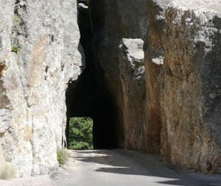
The safety recall on the bus has given us nearly an extra week in the Black Hills. Today offered great weather for photography, so we took advantage of it. As you can see from the collection of pictures above, I included more than usual. And, I had a hard time limiting the number of selected pictures. There were many more of Rushmore, the Crazy Horse Memorial, and scenes along the Needles Highway through the northern end of Custer State Park. For you camera buffs, that mountain goat had to have been nearly a mile away. I used all of the 12X optical zoom. I'm learning to like this camera.
The Crazy Horse Memorial is neither a federal nor a state project. It is being done by a non-profit and has actually turned down some offers of federal funds. Financing is a continuing struggle, but I'm sure it will get finished eventually. The sculptor started, working alone, at the behest of the Lakota elders in 1949. He died in 1982, but his widow and seven of their ten children have made this project their life work. The scale is far beyond the Rushmore carvings. First of all, it is not being carved in relief in the side of a mountain. It will be a three-dimensional statue viewable from all sides. It will be taller than the Washington monument and longer than it is tall! The picture shows a 1:34 scale model in the foreground with the mountain carving in progress behind it.

Saturday, August 16, 2008

Amended Itinerary

We have now adjusted the itinerary to accommodate the extra six days we'll spend in Rapid City (Ellsworth AFB). The original blog posting back in May was the itinerary. It has been edited to reflect these changes. We saved two days by not stopping in Sundance, WY. We'll drive to the Devil's Tower on the way to Sheridan, WY. We'll reduce our stay in Sheridan by one day. Instead of making a stay at Athol, it will be a photo op en route. We'll reduce our stays in Waldport and Bend, OR by one day each. We'll be back on schedule when we leave Bend. Now it's off to our "do over" at Rushmore.

Friday, August 15, 2008

Black Hills update


Here are the three pictures I tried to post yesterday. As I mentioned yesterday, I didn't get the iconic shot of the four presidents. The Washington profile is a nice shot, but, as Cindy said, "You didn't go all that way to come away without the classic Rushmore picture." (Un)fortunately, Freightliner has solved the problem for us. As a result of this morning's safety recall inspection, they have ordered a new steering gear box which they will install on Wednesday, so we'll be leaving Rapid City on the 21st. The itinerary will have to be adjusted accordingly. We'll be doing a lot more of the Black Hills than planned and less of something else. We had some slack here and there, and I'll post the revisions when we figure them out. Andy, the Portland visit will probably get pushed back a couple of days but not change in duration.
To keep life from being boring, USAA called today to say that my MasterCard had been compromised and has been closed. New cards are being shipped here. The only issue is that, with our life style, we have automated the payments of numerous (all) bills and services. The ones that use the card will all have to be updated. What are my odds of catching all of them?
At any rate the good news I'll have a "do over" on the Rushmore picture.

Thursday, August 14, 2008

Rushmore


Today, Thursday, was a rainy day almost all day long. Of course this was the day we chose to go to Mt. Rushmore. The pictures in this blog are almost all wildlife shots. On the way to Rushmore we elected to drive through “Bear Country”, an analog to “Lion Country “, in Florida. The elk are majestic even in captivity. The bears are mostly bored and sorta pathetic. The picture of the arctic wolf is a little out of focus because the auto focus zeroed in on the grass in front of him. The pictures of the pronghorn antelope, deer and bison were taken in Custer State Park, a magnificent, large spread south of Rushmore. Those were not in a game park with fences.
I screwed up the Rushmore pictures. It was raining, and I didn’t get all four presidents. I did, however, get a nice profile shot of Washington through the trees. If our inspection at Freightliner dictates that we spend the weekend, I’ll go back and do it again. This thing won't let me add my last three pictures, and it's time for supper. I'll fix it later.

The Black Hills of SD


On Wednesday the 13th we did our first touring in the Rapid City area. Tuesday, the first full day after we arrived, was a laundry and commissary day. The Badlands are a transition region between an upper level of prairie and a lower one. The area was, eons ago, an inland sea. The layers of shellfish and other aquatic life are still visible as differently colored layers. This isn’t granite, and the erosion is what shapes the terrain. The loop that traverses the Badlands starts about 70 miles east of Ellsworth AFB and ends about 50 miles east. The loop itself was some 50 miles of mostly paved road. At the end of the gravel road was a campground with no utilities but with a nearby grazing herd of a hundred or so bison. We also enjoyed the antics of hundreds of prairie dogs. Along the way we stopped at the farm of an old homesteader from a century ago. There were still sod structures standing. As we exited the national park, we arrived in Wall, SD, home of Wall Drug. The place started as a water stop for the drovers on the cattle drives of the nineteenth century. Now it is a little bit of everything for everyone. It’s a tourist “must see” so we saw it.
On a different note, we got a package of mail from Cindy at General Delivery yesterday that contained a safety recall from Freightliner. It involves the recirculating ball power steering unit. We are going to get it inspected on Friday morning. If everything is fine, we continue on schedule. If not, we’ll lose three days and get away Tuesday morning after they install $900 worth of parts. That means we will get to do more in Rapid City than just the Badlands and Mt. Rushmore. There is a lot more to do. Thursday is Mt. Rushmore.

Monday, August 11, 2008

Ellsworth AFB, SD


Today was a very pleasant day. We got on I-90 at exit 399 in Sioux Falls, SD and got off at exit 67 near Rapid City, SD. For the mathematically challenged that’s 332 miles of straight west interstate with a speed limit of 75. We don't do 75. Our first stop was in Mitchell at the Corn Palace. It’s a worthwhile stop. There are pictures, both inside and out that are done fresh every year using nothing but ears of corn as the artist’s medium. I included an outside picture which doesn’t show the individual ears and an inside picture which does. We made one stop for lunch at a rest area and another, later in the day, at a scenic overlook.
One would think, without having been here, that 330 miles in SD on I-90 would be a mind-numbing, boring day. Let me assure you that “boring” it was not. It is very pleasant to be in an environment where you can see 50 miles without being on a mountaintop. Every time we crested a ridge there was a new panorama of every shade of green and yellow and tan extending to a distant horizon (just as Ann said). It does, however, create a greater appreciation for the Conestoga generation. We climbed to 3,000 feet today which explains, of course, why the mileage dropped to 7.3 mpg.
It was nice today, as we were backing into site 16 at the Famcamp at Ellsworth AFB, to watch a B-1 turning final. It was also very pleasant, as the national anthem sounded loud and clear at 1700, to stand and proudly salute again.